
Landscape history and chronology of a Roman and Byzantine port infrastructure of Marea in the Region of Mareotis – 2020
Tomasz Derda
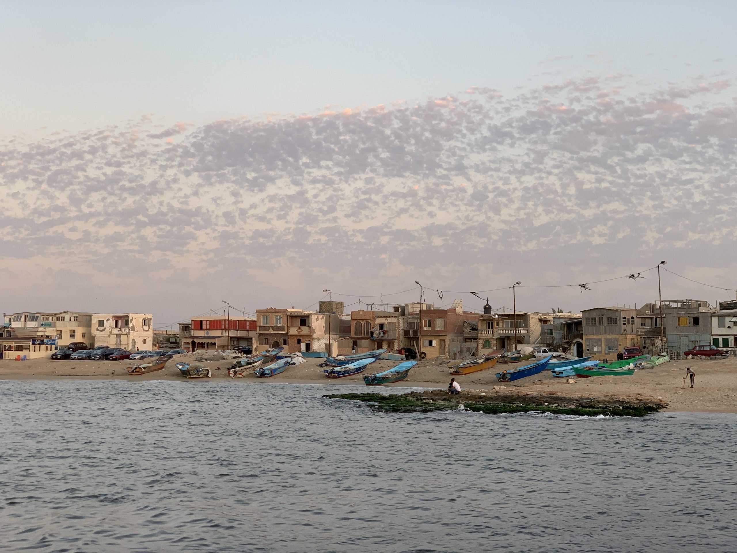
 Marea is situated on the south coast of Lake Mariout around 45 km away from Alexandria. Occupying around 15 ha, it is one of the largest settlements from the Byzantine period located in north-western Egypt. According to Herodotus, the settlement had been a military outpost on the Libyan border that later developed into an important part of Alexandria hinterland. During archaeological excavations conducted by different expeditions (including Egyptian, Polish, American and French) buildings from the Byzantine period (4th–7th c.) were identified; most importantly, baths, a saqiya, a church, a chapel, shops, harbour warehouses and a mill. Other structures, coming from the Roman and Ptolemaic period, have been investigated to a much lesser degree. They include the remains of tower houses from the 3rd c. BC, metallurgic workshops from the 1st c. BC and pottery kilns from the 1st–3rd c. CE.
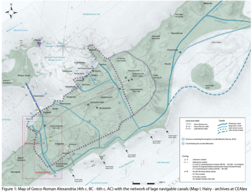
 New geological research aims at reconstructing the coastline of Lake Mareotis and determining whether Marea was originally situated on an island, which would help to identify the crucial factors that influenced its urban development. It seems that the city was an important port. This is suggested by the presence of three quays, a large artificial harbour and large warehouses adjacent to these constructions. Unfortunately, we know very little about their chronology; for this reason we propose to excavate this structures in order to find out whether these buildings were associated with the large-scale export of locally produced wine in the Roman period. However, it is equally possible that the great harbour of Marea was established only in the Byzantine period (4th–7th c. CE) to cater the needs of Christian pilgrim traffic related to the shrine of St. Menas located 15 km south of Marea.
2023 update
The aim of the project was to determine the hydrological, infrastructural, and topographic context of ‘Marea’/Philoxenite. This late antique city in northern Egypt until recently remained unknown to science. Philoxenite was founded on the initiative of Flavius Theodorus Philoxenus Soterichus, consul ordinarius of AD 525, the great figure of Byzantine politics in the days of Anastasius, Justin, and the early reign of Justinian. Around the middle of the 6th century or a little earlier, on the southern shores of Lake Mareotis, this great lord, an important figure in Constantinople’s politics, financed or co-financed the city, which was built according to a well-thought-out urban plan. Built only 40 km from Alexandria, the city with its monumental buildings had to be constructed in cooperation and/or with the support of the bishop of Alexandria, who never allowed an independent bishopric to be established west of his capital.
‘Marea’/Philoxenite was one of the largest settlements located in the western part of Lake Mareotis. Until now, geological research was not conducted here; the chronology of port infrastructure remained also unknown. To change this state of affairs, geological drillings and archaeological excavations were carried out. Using Geological Drilling Machine, data from three sectors of the site as well as from the eastern part of Lake Mareotis were gathered. Diatoms were obtained from them, which enabled palaeobotanical tests. Their chronology was determined based on the analysis of ceramics found in the cores and C14 dating. Furthermore, excavations enabled an analysis of stratigraphic sequences related to the port infrastructure and the ceramic material made it possible to determine the date of its creation.
The results of these studies indicate a significant rise in the water level in Lake Mareotis in the Roman and Byzantine periods. This hydrological optimum lasted until the 8th–9th century AD, which correlates with the greatest development of ‘Marea’/Philoxenite. Geological drilling and excavations at the site revealed that its topography and natural environment was similar to today’s conditions. The wetlands surrounding the site to the south were not below the lake level at times when its level was at its highest. However, excavations in the area have shown that there was a complex irrigation system that allowed for the cultivation of cereals fed with water directly from the lake. Cultivated fields with an irrigation system are a unique discovery on the Egyptian scale.
Excavations at the eastern and northern waterfront made it possible to determine the time of construction of most elements of the port infrastructure at no earlier than the middle of the 6th century AD. This indicates that it was primarily associated with pilgrimage traffic to the sanctuary of St. Menas, not exporting locally produced wine.


