Geoarchaeology of the Kibotos Harbour and its Canal(s), Alexandria, Egypt - ongoing
Matthieu Giaime
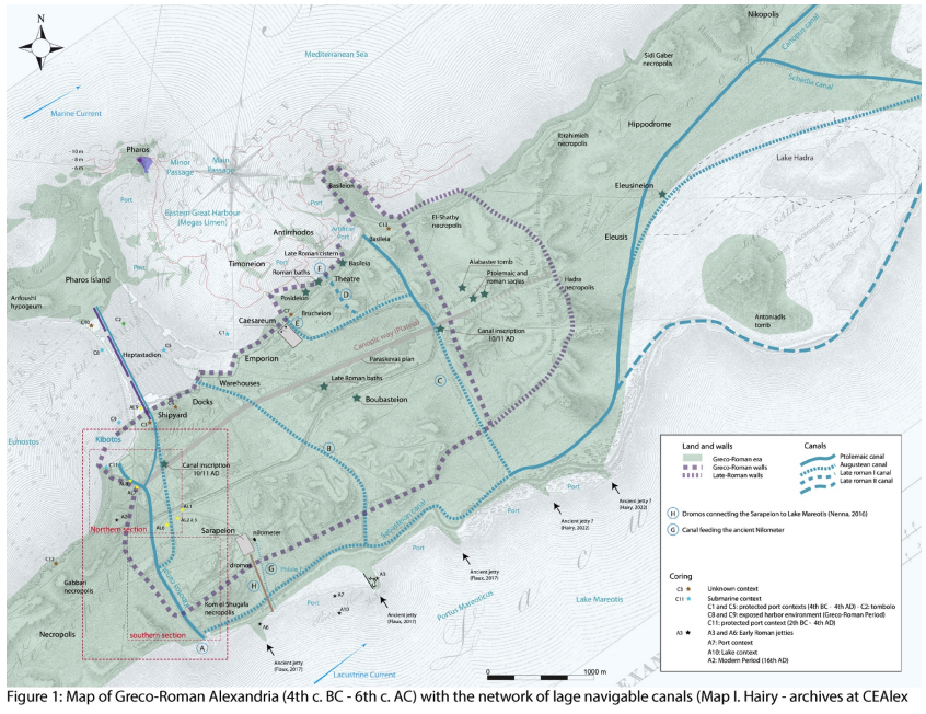
The coast on which Alexandria has settled was bordered by the Island of Pharos, defining a long bay between the capes of Agami in the west and Silsileh in the east. Several ancient authors report Alexander the Great dividing the bay in front of Alexandria into two large maritime port basins by the construction of a long causeway named Heptastadion. At the bottom of the western basin, named Eunostos, had been built an artificial inner closed harbour, the Kibotos, established according to Strabo, not far from the beginning of the Heptastadion and connected to Lake Mareotis by a canal (Strabo, Geography, XVII, 1.10) which ensured an easy connection between the Mediterranean and the interior of the country.
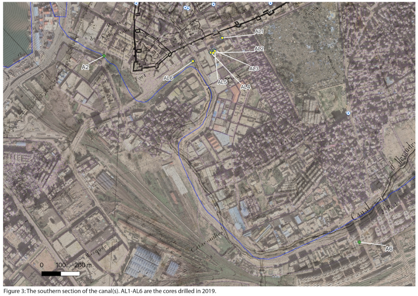
In 2019, our team wondered about the origin of the water supply of the medieval and Ottomans cisterns located west of the city: could they mark the ancient location of Kibotos harbour and the mouth of its canal? In order to answer this question, a coring campaign led by Isabelle Hairy (CNRS) was carried out (Fig. 1). The results of this campaign made it possible to locate the northern section of the Kibotos canal (Fig. 2, AL6 and AL8) and the position of the ancient coastline to the west of the start of the Heptastadion (Fig. 2, AL9). The Kibotos and its canal are objects of study at the crossroads of historical, archaeological and geoarchaeological approaches. The objective of the new coring campaign carried out thanks to the support of the Honor Frost Foundation will be to find the route of the canal(s) on its southern section, establish its chronology and clarify how it operates in relation to regional hydrological changes linked to the annual flood of the Nile river.