Dreamer’s Bay, Akrotiri, Cyprus – ongoing
Scroll down to view project reports and see the project gallery.
Professor Simon James
Dreamer’s Bay lies on the southern coast of the Akrotiri Peninsula (akrotiri meaning ‘promontory’). The peninsula is a unique and, by comparison with much of the rest of coastal Cyprus, exceptionally well-preserved block of coastal land, famed for its wildlife. It also contains extensive and important archaeological remains, most famously the Aetokremnos site with pygmy hippo bones and the earliest evidence of human activity on Cyprus (c.12,000 cal. BP: Simmons 2001, 2013).
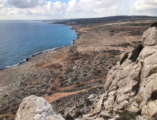
The peninsula comprises a rocky former island, 9.6km long from Cape Zevgari in the west to Cape Gata in the east, and about 3.5km north-south. The land rises gently from north to south, reaching 60m above sea level, and terminating on its southern edge in cliffs, except for a stretch of low shoreline at Dreamer’s Bay. Akrotiri is now connected to Cyprus proper on the west side by a massive tombolo beach of large pebbles, and on the east side by a broad sand beach which runs into the outskirts of Limassol.
The southern coast of the peninsula consists of high cliffs or very steep eroding slopes except for one area in the west about 600m long, where a stretch of lower-lying land projects somewhat into the sea. Here, around Dreamer’s Bay, the shoreline stands nowhere more than about 5m above sea level, with eroding rocky ledges and inlets, some of which have accumulated tiny sandy beaches. In this area human communications between sea and land are practicable, especially as the bay to the east formed a practicable natural anchorage, its use confirmed by the submerged ancient artificial breakwater, anchors and other archaeological remains known on the sea floor. This part of the southern coast has been largely protected from human interference by its location within the UK RAF base security perimeter, but in an area away from the main airfield complex and residential zone. With the exception of vehicle tracks and some surface features, it is largely undisturbed. However, its location on the coast and the soft bedrock has resulted in erosion and many of the walls are visible in wave-scoured surfaces and cliff edges eroding into the sea.
Remains of masonry buildings along the shoreline at Dreamer’s bay were reportedly first exposed during heavy rains c.1973-4 (Heywood 1982, p.167). The remains visible on the surface at the start of the project in 2015 comprised masonry wall foundations and scatters of pottery and other material at various points along the east-west shoreline. In the 1980s, in the cliff-lined bay east of the known shoreline buildings, a submerged artificial breakwater, built on an existing area of reef, was spotted from the air, and subsequently captured by aerial photography. It was subject to preliminary survey work by local avocational archaeology workers which identified ancient anchors and ceramic concentrations thought to attest wrecks (Leonard and Demesticha 2004). The breakwater remains undated, but it has been suggested it is Hellenistic (Leonard et al. 2007).
Since 2000, survey work conducted by John Leonard and Stella Demesticha (Leonard and Demesticha 2004) led to a wider US/Canadian project at Dreamer’s Bay. This was unfortunately cut short due to funding problems and the tragic early death of Danielle Parks (Leonard et al. 2006; Leonard et al. 2007; Ault 2010; Ault and Leonard forthcoming). Work at the site was largely confined to cleaning and recording of some of the remains, some experimental geophysical survey work, and a start on survey of the submerged archaeology. Examination of the onshore evidence indicated that the buildings appeared to be associated with extensive quantities of overwhelmingly late Roman/early Byzantine ceramics, although some Hellenistic and earlier Roman material was also noted. The structures were identified as probably warehouses (horrea) rather than residential.
Archaeological remains inside RAF Akrotiri and the wider UK Sovereign Base Areas belong to the Republic of Cyprus, although they are in the stewardship of the Sovereign Base Areas Administration, and are monitored by the UK Defence Insfrastructure Organisation’s archaeology team, specifically Philip Abramson. His inspection of the exposed shoreline remains confirmed they were under immediate threat, due to intense rainfall runoff and waves during winter storms eroding them into the sea.
The School of Archaeology & Ancient History has broad expertise in Mediterranean archaeology, although not previously in Cyprus. The School entered discussions with DIO regarding undertaking the urgent archaeological rescue work at Dreamer’s Bay as the potential first stage of a wider university research fieldwork scheme on the peninsula (the Ancient Akrotiri Project). Even as plans were developed to investigate the remains at Dreamer’s Bay, it was soon apparent these could only be understood in relation to the rest of the archaeology of the peninsula, in the setting of the wider region of south central Cyprus, especially the contemporaneous city-states of Kourion and Amathous; hence the choice of project name. The project has also been a collaboration from the outset. While led by the University of Leicester, the planned comprehensive study of the ancient port required underwater research, and so the UK’s leading centre of maritime archaeological expertise, the University of Southampton, was invited to participate. Led by Dr Lucy Blue, Southampton’s contribution also included geomorphological aspects, now undertaken by Miltiadis Polidorou of the University of Athens. As of 2018 Prof Stella Demesticha of the University of Cyprus also kindly joined the project, to study the pottery. Just as important as the academic partnerships are the close collaborations with UK MOD and the Republic of Cyprus Dept of Antiquities, the Akrotiri Environmental Education Centre and the WSBA Archaeological Society, which make the project possible.
The research questions at Dreamer’s Bay include:
- What is the nature and extent of the occupation? It clearly involved harbour works and apparently had peripheral cemeteries, but how large was the built-up area, and what can we discover about its layout and nature?
- When was it established, and how and why did it develop? Was it indeed a Hellenistic foundation as has been posited? Was its flourishing related to the silting up of the channel which turned Akrotiri from island to peninsula, creating a need or opportunity for a harbour at the site? Did the earthquake which devastated Kourion and its region around the AD360s play any role?
- What trading functions did the site have, and with which Mediterranean trade routes did it engage?
- How did it meet its end?
- What might be done to preserve the archaeological remains, and to present the evidence to public audiences?
2019 marked the fifth year of onshore and underwater research at Dreamer’s Bay, during which most of the research questions have been answered, or are set to be during post-excavation analysis. Dreamer’s Bay appears to have served multiple functions during its use as a harbour, which may have had Hellenistic origins but now looks to have flourished during the Roman imperial as well as early Byzantine periods (roughly the first six centuries AD).
It apparently served as an industrial harbour for export of marine conglomerate products from quarries above the bay; as a trading and probably fishing port for the communities of the peninsula, and probably for the nearby city of Kourion; and likely as a watering, victualling and light repair stop for shipping using Akrotiri as landfall or point of departure on ‘blue water’ routes between the Aegean, Levant, and Egypt.
The onshore and marine infrastructure at Dreamer’s Bay appear to have been devastated by natural events—earthquake, major storm or perhaps a tsunami—although this is to be confirmed. It is not yet clear if this was the same catastrophe which struck Kourion around the 360s, although provisional assessment of the onshore ceramic evidence suggests the events were contemporaneous, while also showing that activity continued at Dreamer’s Bay into the seventh century.
A major project conclusion is that Dreamer’s Bay was not a port town, as previously assumed; surface survey, trenching and geophysics showed that the hypothesised residential zone behind the shoreline warehouse complexes did not exist. Rather, Dreamer’s Bay represents a concentration of maritime facilities operated by people who lived in the several Classical era/late Antique villages across the middle of a peninsula which now looks to have comprised a single, integrated maritime landscape. Dreamer’s Bay was rather a cluster of components of a network of sites and communities which also exploited the potential of Akrotiri’s other shores, notably the more sheltered east coast, and (following Leidwanger), even the exposed western shore, on an opportunistic basis. On the north shore of the rocky part of the promontory, the Salt Lake had apparently already formed by Roman times.
This last point is an implication of very important spin-off work from the project, conducted in collaboration with Geologist Mitiliadis Polidorou. Geomorphological research undertaken to investigate the history of sea level changes at Dreamer’s Bay harbour and around the peninsula involved analysis of core samples from the Salt Lake. These revealed vital new evidence regarding the chronology of formation of the great tombolo beaches which turned Akrotiri from a small offshore island into a headland. It is now clear that this was not, as hitherto thought, an event reaching completion in recent millennia; rather Akrotiri was already connected to Cyprus before the Holocene. This discovery has major implications for understanding the developing ecology, and the human settlement, of the region.
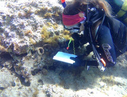
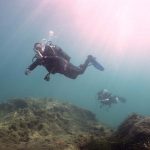
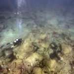
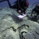
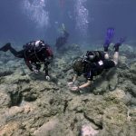
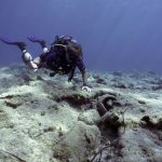
The aim of the 2019 underwater survey was to further investigate the ancient breakwater, complete an underwater survey of Dreamer’s Bay and to investigate a ceramic concentration to the east of the breakwater. The breakwater was extensively surveyed in 2018 both visually and photogrammetrically. The focus of 2019 was to calculate the volume of the rubble that had fallen from the breakwater largely to the east of the structure, in order to ascertain its original height and scale. The area around the breakwater was also more thoroughly investigated and a channel some 5-6m deep was clearly mapped to the east of the breakwater noting an entrance to the more sheltered water in the lee of the structure, an area of anchorage. Survey conducted by divers using underwater scooters, enabled wider coverage of the offshore approaches, identified new finds including numerous stone anchors and what appears to be the remains of a wreck carrying roof tiles, still of uncertain date. To the west of the breakwater other concentrations of ceramics were also noted, however, survey further offshore to the west in front of the shoreline buildings excavated by the Leicester team, still failed to identify any archaeological remains, making the theory that this was an area used as a roadstead, less feasible. All finds were noted, described and photographed underwater and a record of their location taken using GPS. Selected finds were lifted only when they were either in danger of further displacement on the seafloor or were useful chronological indicators.
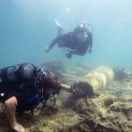
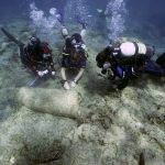
The most important result of the 2019 underwater season was confirmation that the eastern concentration of largely homogenous ceramics located on an elevated, rocky outcrop to the east of the breakwater and the sheltered channel, was indeed a shipwreck. Dating to the end of the 6th or the 7th century AD, as confirmed by ceramics expert Dr Stella Demesticha of the University of Cyprus, the extensive remains of broken amphorae were identified scattered over an area of approximately 130,000sqm, concreted to the rocks and caught in gullies. In the middle of the wreck lies an Aswan granite column also believed to belong to the vessel. The area was extensively surveyed and the number of amphora shoulders and rims were counted equating to almost 800 in total, reflecting a fairly substantial vessel for the period. Examples of the amphorae were lifted for further analysis, which is still ongoing.
The Ancient Akrotiri Project has from the outset included a major outreach component, engaging with both the UK military and local Cypriot communities through events, visits, talks and education programmes. Collaboration with the Akrotiri Environmental Education Centre has been central to this. The programme is ongoing, and includes provision of new bilingual interpretation signage at key archaeological sites, and eventually permanent presentation of project results at Akrotiri and/or the Kourion Museum, Episkopi.
Survey and excavations at Dreamers Bay 2017
Survey and excavations at Dreamers Bay 2018
Underwater Survey Report 2018 – Lucy Blue
Survey and excavations at Dreamers Bay 2019
Akrotiri Salt Lake’s Living Histories – 2019
Underwater Survey Report 2019 – Lucy Blue
More information about the Ancient Akrotiri Project can also be found here
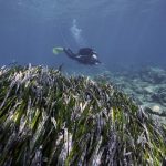
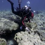
Below are photographs from the 2019 dive season, courtesy of Steven Lopez
Geoarchaeology of the Akrotiri Peninsula – Dr. Ferréol Salomon – 2018
The aim of the project was to undertake palaeo-environmental research that contributes to the Ancient Akrotiri Project, Cyprus directed by Prof. Simon James (University of Leicester), which involves the excavation of the Roman port at Dreamer’s Bay on the southern side of the Akrotiri Peninsula and interpretation of its results in the context of the southern coast of Cyprus. It also contributes to the ERC funded PortusLimen Project directed by Prof. Simon Keay based at the University of Southampton (www.portuslimen.eu), which is employing a range of archaeological, geo-archaeological and historical approaches to the study of c. 32 Mediterranean ports of Roman Imperial date.
Centrally located on the southern shore of Cyprus, on the maritime routes between the Levant, Egypt and Greece, the Akrotiri Peninsula reveals many archaeological sites especially from the Hellenistic, Roman, Byzantine and Venetian periods. This continuous occupation of the area has to be related to the specificity of the landscape. The Akrotiri Peninsula can be considered to be a rare geomorphological site called a “double tombolo”, i.e. an island attached to the mainland by two coastal spits. These two spits enclose a water body that offered different kinds of harbour potential through time. This project aimed to reconstruct the formation of the two tombolo beaches, establish the date by when the Akrotiri Island became connected to mainland Cyprus, and evaluate the harbour potential between the Akrotiri Island and Cyprus in terms of the available water column and the degree of closure of the water body. The results of this work, therefore, will shed light on the maritime role that the port at Dreamer’s Bay may have played during the Roman period.
In September 2016, the team drilled four cores with the company Geoinvest in the Salt Lake of Akrotiri with the support of the Sovereign Base Areas Administration of Akrotiri (SBAA and Akrotiri Environmental Center) and the Geological Survey Department of Cyprus. The Honor Frost Foundation supported the multi-proxy palaeo-environmental analyses of the sedimentary cores. The combination of grain size analysis, geochemical analysis and bio-indicator determination (shells, ostracods etc.) with radiocarbon and OSL dates, provides information about the chronology of the formation of the first and second spits, and the sedimentation rate of the lake. These cores will provide important results regarding: (1) the palaeo-geographical reconstruction of the Akrotiri Peninsula over the last six millennia; (2) and gauging the changing harbour potential of the lagoon through time.
This research involved collaboration with colleagues at the University of Southampton (Dr. Lucy Blue, Dr. Helen Farr and Dr. Nicolas Carayon), the University of Strasbourg (PhD candidate Cécile Vittori), University of Northumbria (Dr. Matthew Pound, Dr. Emma Hocking, PhD candidate Calian Hazell,), the University of Athens (PhD candidate Miltiades Polidorou), and the Geological Survey Department of Cyprus (Dr. Zomenia Zomeni).
Preliminary interpretations suggest that the team drilled through two stages of the formation of the double tombolo of Akrotiri during the Holocene. The initial radiocarbon dates available for the four cores range between the 5th and the 1st millennium BC. Middle Holocene dates were obtained in the core drilled to the west and more recent dates were mainly recorded in the cores drilled in the east. At the base of each core, well sorted yellow sand with scarce small pebble might correspond to pre-Holocene deposits. Marine shells were identified in these units. Brown clayey silts drilled in Core Ak-4 and the dark grey / bluish silty sands identified in each stratigraphic sequence, reflect sediments that were deposited in sheltered to semi-sheltered environments with mixed fluvial and marine influences. Shells, pollens and geochemical analyses show some variations in the salinity through time. Finally, the upper level of brown silty sand with a high content of ostracods and foraminiferae relate to a second phase of evolution of the tombolo, leading to the current enclosed Salt Lake of Akrotiri. A publication for a scientific journal is in preparation. It will present the detailed analyses performed for each core.
To read the project report click here
Palaeogeographic reconstruction of Akrotiri salt lake – Miltiadis Polidorou – 2017
The main aim of this project was to shed light on the palaeogeography of the broader Lemesos salt lake area and the possibility that there existed a deep enough bay to host a harbour some time in antiquity.
The Akrotiri peninsula is located 5km west of the city of Lemesos and is the southernmost part of the island of Cyprus. It is bounded on the west by Episkopi bay and to the east by Lemesos bay. The palaeogeographic evolution of the Akrotiri peninsula presents a great scientific interest, especially during the Holocene period where the eustatic movements (sea level change) combined with the local tectonic movements and the climate change have developed a unique geological and geoarcheological environment. In particular, the decoding of the palaeogeographic evolution of the Salt Lake will become a tool for assisting Holocene geoarchaeological work in southern Cyprus coast which hosts sites like Palaipafos, Kourion, Amathus and Kition.
Read the final report for the project here
Dreamer’s Bay Underwater Survey 2022 – Dr Lucy Blue and Dr Stella Demesticha.
The present proposal, for September 2022 1st – 14th is primarily for underwater archaeological work, with some geological and geoarchaeological tasks. This will be part of the wider investigation of the Classical/Late Antique port landscape conducted by the Ancient Akrotiri Project, led by Prof Simon James of the University of Leicester.
The 2022 underwater survey season will focus on continuing the broader survey of Dreamer’s Bay to better understand the full extent of its role within this complex maritime cultural landscape. The project will continue to analyse the context and role of the breakwater and its connection to the identified wrecks. It will also reinvestigate the shipwreck dating from roughly the 6th century AD that has been identified to the east of the breakwater. Finally, a large focus of the underwater survey aims to provide determine greater understanding of the wreck carrying roof tiles and revisiting the nearby anchors to better understand their relation to the site. The broader objectives will expand the survey to the areas further offshore and to the east, in order to have a holistic understanding of this area.

Underwater Survey Directors: Dr. Maria Michael and Dr. Lucy Blue
The third underwater investigation at Dreamer’s Bay on the southern shores of the Akrotiri Peninsula, Cyprus took place between June 23rd and July 3rd, 2023. This was part of the wider investigation of the Classical/Late Antique port landscape conducted by the Ancient Akrotiri Project, led by Prof Simon James of the University of Leicester. A team of professional diving maritime archaeologists, photographers, divers, and surveyors from Cyprus, the UK, and the USA, further investigated the ancient breakwater and the surrounding sea floor in Dreamer’s Bay. The work was carried out with the approval of the Department of Antiquities, Cyprus, and the UK Sovereign Base Areas Administration. RAF personnel helped in the preparation and offered their time, expertise, and support during the field season.
This season mainly achieved the following five main tasks:
- further investigation and topographical record of the ancient breakwater.
- detailed and systematic mapping and photogrammetry of the tile wreck to determine its greater understanding.
- revisiting the nearby stone anchors to better understand their relation to the site. Two of the anchors were lifted and transferred to the Local Archaeological Museum of Kourion in Episkopi.
- offshore survey to achieve a holistic understanding of this area.
- further investigation and analysis of the ceramic concentration to the east of the breakwater in order to determine its nature. Selected finds were lifted only when they were useful chronological and typological indicators.
The survey generated much interest in the local news (see links below). A more analytical archaeological report will follow soon.


