
A Virtual Tour and 3D Presentation of the Inaccessible Heritage of the Berenike Red Sea Port
Dr. Mariusz Gwiazda
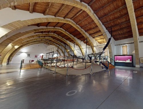
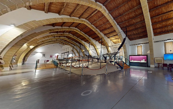
Berenike, a historical port town in Egypt situated along the Red Sea coast (coordinates 23°54’42.9”N 35°28’25.9”E), had a significant role in the intercontinental trade of luxury goods between the 3rd century BC and the 6th century CE. This bustling settlement acted as a vital link connecting various civilizations across Africa, Asia, and Europe during its heyday. Over the course of more than two decades of excavation efforts, Berenike has offered a treasure trove of insights into the ancient economy and the cultural interactions that shaped its history.
Today, Berenike remains within a restricted area, making it inaccessible to the general public. However, a our project aimed to transcend this limitation, allowing people who were previously unable to visit the site to experience its wonders virtually. This endeavor involved the creation of a digital tour of Berenike using Google Street View applications. Additionally, an IT system was developed, featuring interactive maps and three-dimensional models of the structures discovered during excavations, accompanied by explanations in more accessible language.
The virtual tour was fashioned using the Google Street View application, harnessed through smartphones equipped with GPS and cameras. The resulting materials were integrated into the Google Maps platform, providing an unrestricted visual journey. The mapped route was superimposed onto topographical or satellite images, forming a guide that users could follow by clicking on marked points. These points linked to on-site photographs, complete with arrows to simulate movement through the site.
To enrich the virtual experience, the project incorporated geotagged 360-degree panoramas into Google Maps. These panoramas offer a more immersive view of the landscape, especially given the variable terrain in Berenike. Around 205 georeferenced photos were meticulously uploaded to the Google Maps system, albeit after minor graphic touch-ups to enhance their visual quality.
The virtual journey not only covered the landscape but also extended to three-dimensional models of the excavated structures and artifacts. A comprehensive process encompassing data collection, model creation, and website development was undertaken.
This approach allowed for the detailed documentation of five excavated trenches within the northwestern necropolis. These models, unburdened by speculative reconstructions, illuminated not only the architectural structures but also the original placement of furnishings. Each model was accompanied by a succinct description, enhancing its accessibility to the general public.
At its core, the project’s crowning achievement lies in enabling exploration of Berenike’s inaccessible heritage. By facilitating unrestricted virtual tours enriched with photographs, 360-degree panoramas, and interactive three-dimensional models, the initiative has offered an unprecedented glimpse into Berenike archeological site. Significantly, the project extended its focus beyond the traditional emphasis on material culture, acknowledging the landscape’s pivotal role in shaping ancient settlements and communities. In doing so, it presents an immersive experience that captures not only the artifacts but also the environmental context in which they existed.
To take the virtual tour of Berenike, please visit this website!


