Introduction
Lucy Blue, Maritime Director
In 2021 HFF awarded a grant to conduct the first of what later became two field seasons in coastal Gaza. The Gaza Maritime Archaeology Project (GAZAMAP) was developed as part of the Maritime Endangered Archaeology of the Middle East and North Africa (MarEA) project, and is directed by Dr. Georgia Andreou, a MarEA research assistant based at the University of Southampton and Yasmeen Elkhoudary based at the Council of British Research in the Levant, UK.
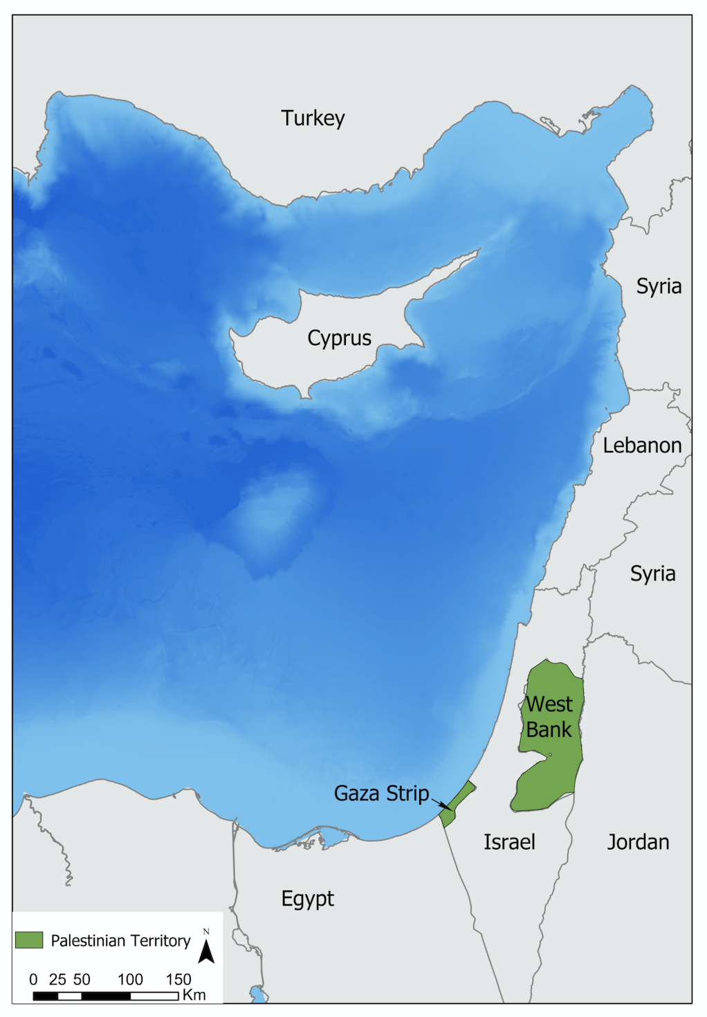
A remote assessment conducted by the MarEA team of coastal Gaza, demonstrated the widespread impact of coastal erosion, building development, conflict and illicit digging on Gaza’s archaeological sites. This was the incentive for the team to seek support from the HFF to enable sites to be assessed on the ground. An initial reconnaissance undertaken by Yasmeen Elkhoudary of a selection of sites in December 2021-January 2022, confirmed the detrimental impact of these factors on the maritime archaeology. Preliminary discussions with the Deputy Department of Antiquities, Gaza (Ministry of Tourism and Antiquities) confirmed that archaeological sites were in urgent need of detailed documentation and protection. As a result, two seasons of field work have subsequently been conducted (2022, 2023) targeting the key sites of Tell es-Sakan (the largest archaeological site in Gaza) located north of Wadi Gaza and a series of Iron Age partly submerged coastal sites located to the south, including Tell Ruqeish, Tell Qatif and Tell Ridan.
GAZAMAP is the first maritime archaeology project in the Gaza Strip since the 1970s and the first research archaeological project in this area since the early 2000s. It has successfully documented in detail, a number of key sites, expanding knowledge of the maritime archaeology of the region. It also works closely with local archaeologists and heritage professionals, journalists and media production companies and delivers training to archaeology and GIS students in the documentation of maritime archaeological features. The project was also supported by the University of Southampton Strategic Research Fund and was included in a successful funding application to the British Council, which recognised the potential of delivering specialised training in underwater heritage documentation.
Results from 2022
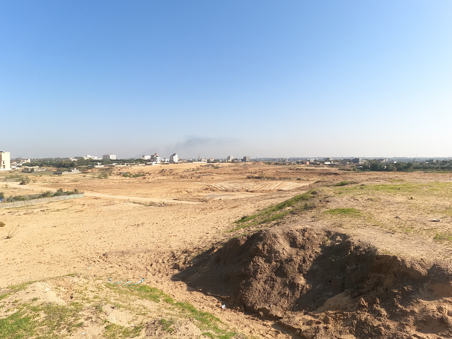
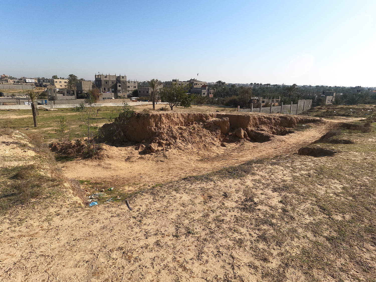
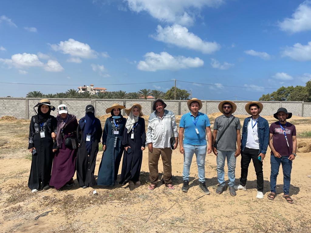
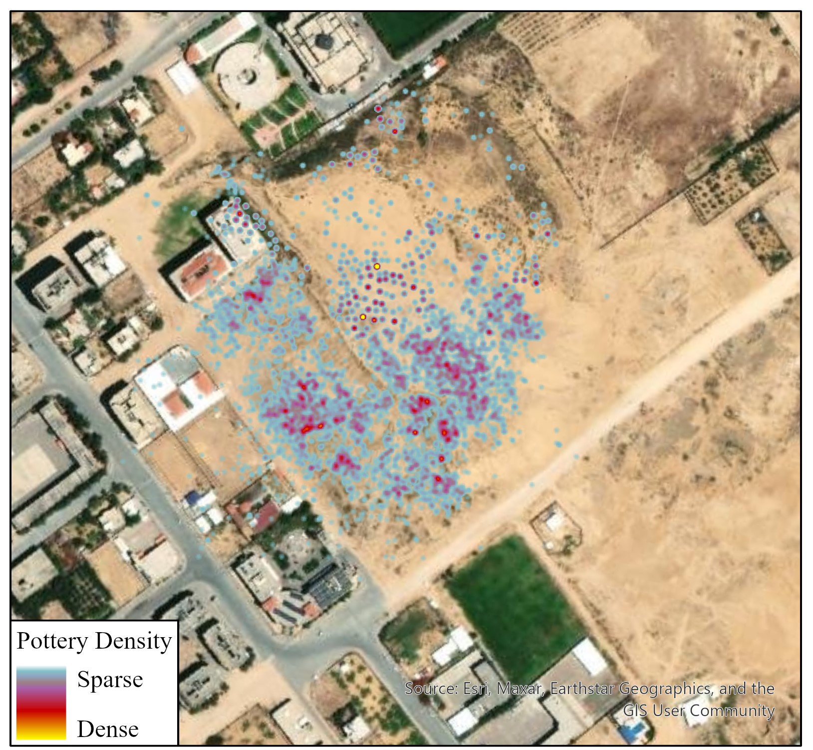
During 2022, GAZAMAP was carried out in collaboration with the Ministry of Tourism and Antiquities and the Islamic University of Gaza aiming to deliver training to students and heritage professionals and conduct detailed survey of the tells and adjacent beach. Capacity building involved remote teaching followed by in situ training on drone and topographical surveys by local companies. Aerial photographs were collected and then processed to produce site plans and 3D models, which informed the location of the survey grids. The surveys were conducted by 10 students guided by Dr Ayman Hassouna (Islamic University of Gaza). Simultaneously, a local diver produced underwater footage off Tell Ruqeish.
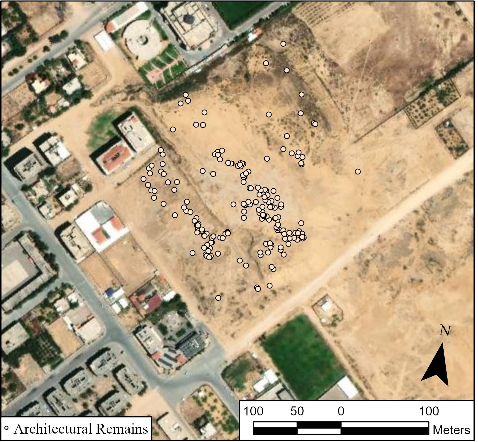
To collect field data, we used KoBotoolbox an open-source software using GPS from the users’ smartphones to save the location of field observations. The students took scaled photographs enhanced with field notes, all of which comprise the full record of each surveyed site. About 20000 observations were collected from the sites, each accompanied by 1-3 photographs and notes on the condition of the features. Observations include pottery sherds, flint, ground stone tools, shells and architectural remains, the location of which was then visualised on GIS to produce site plans.
The surveys produced updated site plans that enhance ongoing efforts by the Ministry to protect Tell Ruqeish and Tell es-Sakan. Most importantly GAZAMAP highlighted education opportunities by the HFF, through which students can leverage the newly acquired skills and data to produce updated narratives of Gaza’s rich maritime heritage.
Enhancing existing skillsets and creating for the first time networks of stakeholders interested in Gaza’s maritime landscape (archaeologists, coastal engineers, geologists) GAZAMAP and HFF have formed a steppingstone for formal and more targeted training programmes on coastal monitoring and heritage management in an area inaccessible to archaeological research for almost 20 years.
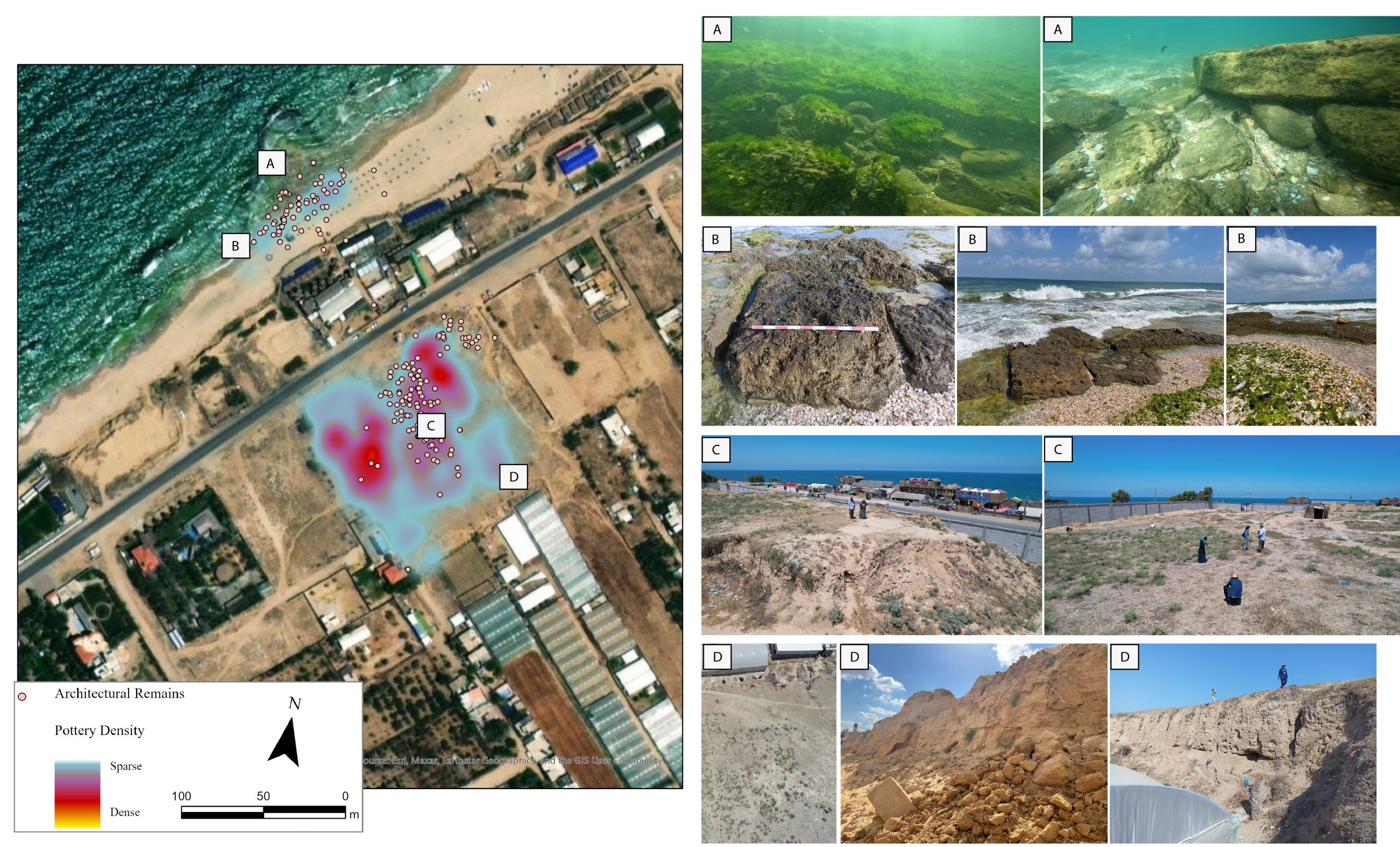
The project has provided a summary of all available information on the site of Tell Ruqeish, originally excavated by an Israeli team and currently unavailable to heritage professionals in the Gaza Strip. These include a reconstruction of the known extent of the site, a more detailed mapping of its submerged features and a preliminary classification of finds, which include substantial numbers of imported pottery.
At Tell es-Sakan, the project provided an up-to-date map of all exposed archaeological features and engaged with more recent scholarship on the topic of Egyptian colonisation in the Southern Levant. This offers valuable data to the Ministry to pursue further protection of the site under ongoing and imminent threats of building development.
The Gaza Maritime Archaeology Project (henceforth GAZAMAP) is the first maritime archaeology project in the Gaza Strip since the 1970s and the first research archaeological project in this area since the early 2000s. The project has concluded a successful first season in 2022, during which we trained eleven students to conduct a maritime survey at: (1) the Iron Age port city of Tell Ruqeish, and (2) a 4th millennium BCE Egyptian colony at Tell es-Sakan. The 2022 season expanded knowledge on Gaza’s maritime archaeology and introduced new themes in existing university curricula focusing on maritime archaeological skills. The preliminary results of GAZAMAP have produced updated site maps, raising the profile of maritime archaeology in Gaza.
The results of the 2022 season made clear that there are multiple undocumented submerged archaeological features across the coastline of Gaza. It also highlighted that, despite several restrictions in place, some spatial data collection technologies are available in Gaza, including drones and topographical survey equipment, both of which are used in the private sector. Bringing together heritage professionals with those knowing how to operate these technologies has significant potential for the protection of heritage in Gaza. Since 2022 we have created a collaborative network of specialists, the complementary skills of whom have produced high-quality archaeological data for the study of Gaza’s maritime heritage. It is important to maintain this network, as well as our collaboration with the Ministry of Tourism and Antiquities (MoTA) through regular engagement in fieldwork.
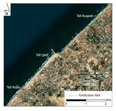
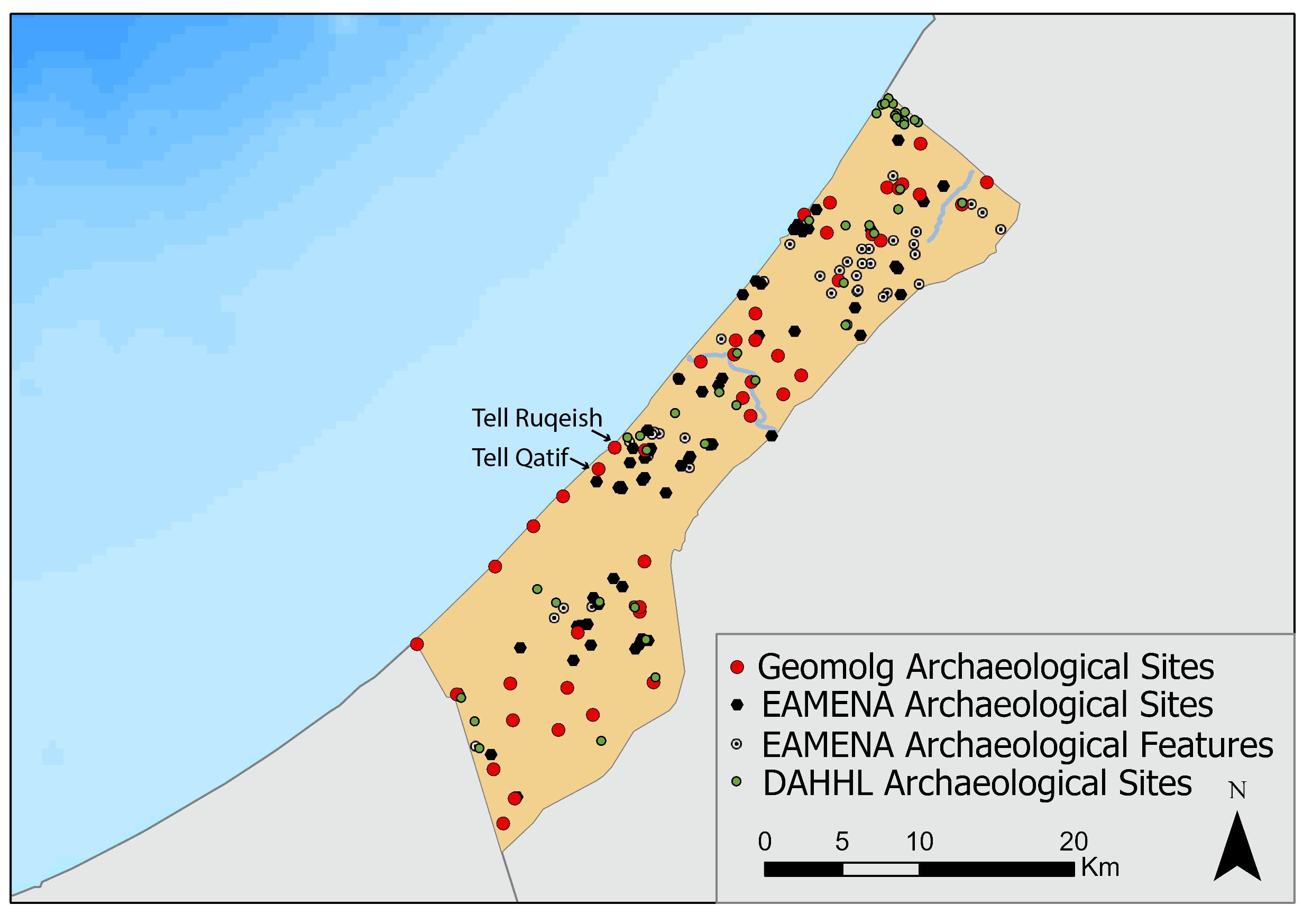
This report outlines the results of the 2023 season, which took place between June and August 2023 and focused on the coast of Deir el-Balah and Khan Yunis, including the survey of the coastal Tell Ruqeish, Tell Qatif and Tell Ridan (fig. 1). Tell Ruqeish was partly surveyed in 2022, when we established that the coastal front of this Iron Age site likely extends to 600m and is accompanied by a monumental wall. In 2023, we extended our survey 4km to the SW, to include Tell Qatif, a site with reported Iron Age features, and Tell Ridan, an area with a reported Iron Age stone quay. Our aim was to determine the materiality of Iron Age maritime activities in this region, but also to examine the relation of the three sites as part of a large and significant Iron Age maritime landscape.
The 2023 season built on the skills of already trained students to conduct a more systematic documentation of maritime features. It also trained an additional 10 students pursuing degrees in archaeology and GIS at the Islamic University of Gaza. In 2023 we also engaged more productively with the local communities, through community engagement events.
Full 2023 Fieldwork Report Available here
Since October 2023, we have been monitoring closely the impact of the war on known archaeological sites. In this report, we are focusing largely on maritime archaeological sites, though heritage destruction is also extensively documented in the historic core of Gaza city. We unfortunately also need to report that one of our students (Moatasem Habeeb) and two of our partners from Ain Media (Rusdhi Sarraj, Ibrahim Lafti) have been killed during the course of the conflict. Moatasem, was an extremely hard working and ambitious archaeology student, who worked with us since 2022 and was going to receive maritime archaeological training in Egypt (CPF).
Our observations derive from a combination of satellite image analysis (Planet.com) cross-referenced with trusted local informants and relevant social media posts accompanied by photographs.
Based on these we observed that heritage in Northern Gaza has suffered the most. Satellite imagery in November clearly shows the bulldozing of long stretches of coastal land that facilitated military access.
The affected sites include:
Anthedon Harbour
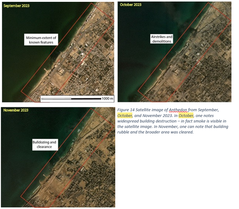
Anthedon harbour, which spatially coincides with the modern Shati refugee camp. Anthedon includes exposed and excavated features dating from the Iron Age to the Byzantine periods. The density of archaeological features, most of which covered by modern architecture, but also the archaeological importance of the finds made Anthedon the most important site in the Gaza Strip. A testament to its local importance is Anthedon’s inclusion in the UNESCO tentative list (Anthedon Harbour – UNESCO World Heritage Centre). In fact, MoTA suggested Anthedon as a suitable area for a comprehensive underwater survey by GAZAMAP. Anthedon was damaged by airstrikes in 2014 and 2021 (Andreou et al. 2022). The impact of the 2021 airstrikes is the most extensively documented (Living Archaeology In Gaza ← Forensic Architecture (forensic-architecture.org).
Preliminary observations on satellite imagery before and after November 2023 clearly demonstrate the impact of airstrikes and subsequent clearance through bulldozing (fig. 14). Not far from Anthedon is the Al-Mathaf Museum, a private collection that in 2007 was transformed to an archaeological museum open to the public. While the building was certainly damaged, it has not been demolished. Trusted local sources informed us that the building was used as a military station. Some of the museum collections derive from the sea off Anthedon, which is known to local fishermen and divers as a source of antiquities.
Maioumas
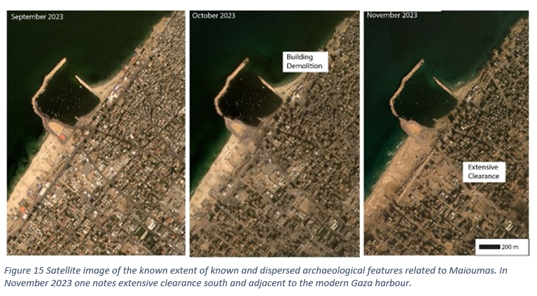
Maioumas includes the Byzantine and Islamic components of the Gaza harbour, including historical buildings, traces of a “crusader” wall and reported surface pottery. In the recent years, this area developed into Gaza’s modern harbour, the construction of which has very likely removed any submerged features related to historical maritime activity. Nevertheless, MoTA informed us that archaeological features are a common occurrence during building and road construction and improvement works. In other words, substantial remains are presently below post-Medieval and modern structures. Based on news reports and social media posts, and confirmed through satellite imagery, Gaza’s harbour has been damaged by airstrikes, which caused the demolition of surrounding structures in October. By November, one notices on satellite imagery the clearance of rubble, which likely resulted in the removal of any remaining traces of antiquity in this area (fig. 15).
A full report on the impact of the war on known archaeological sites and this project is available in the 2023 Fieldwork Report