
Tel Achziv Excavation Project – 2014-2017
Dr Michael Jasmin
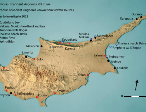
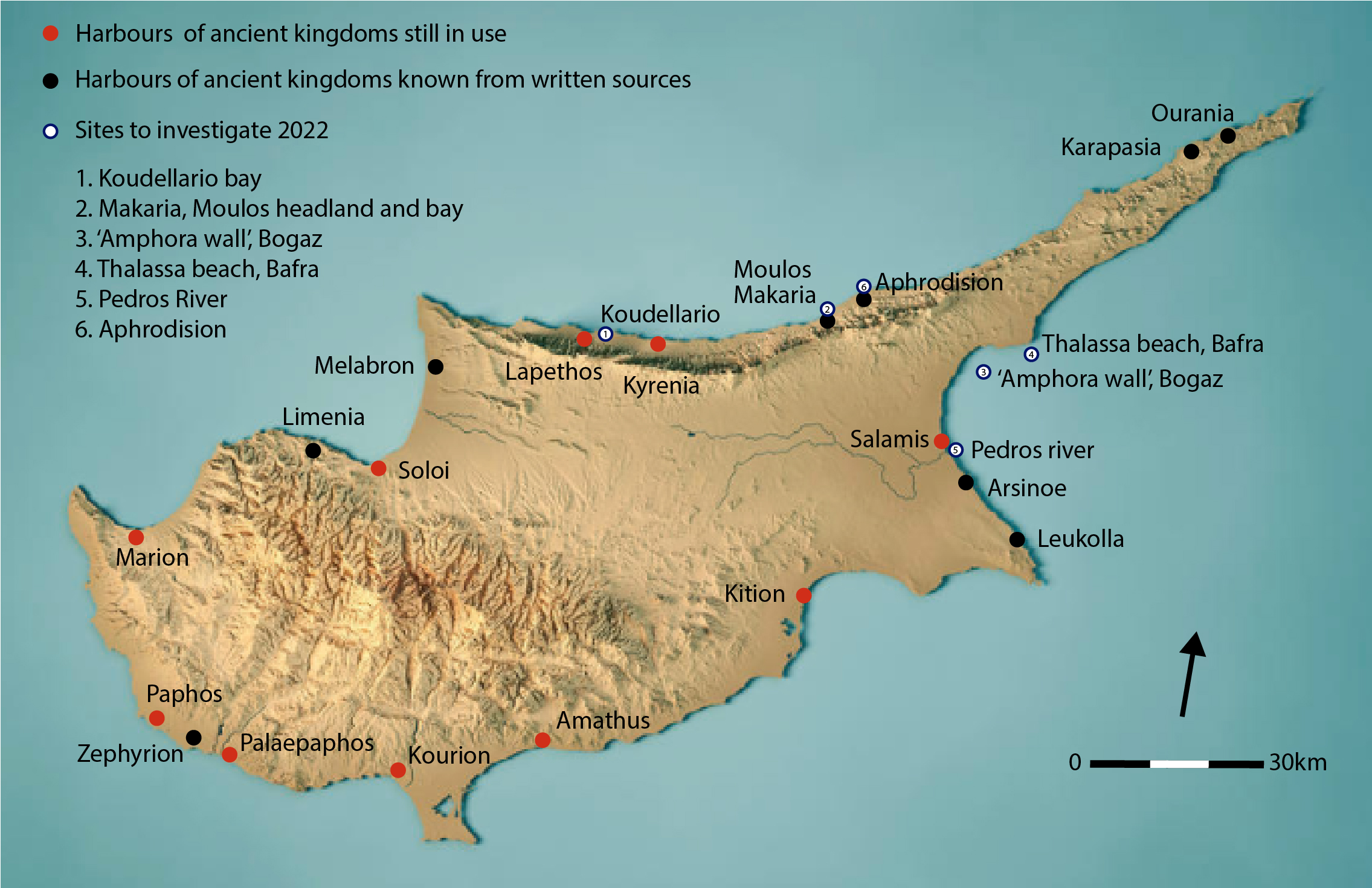
Tel Achziv (Tell ez-Zib) (1598.2726 Israel Coordination Map) is situated on a natural coastal sandstone (kurkar) ridge to the south of Nahal Kziv (Wadi Qarn) and to the north of Nahal Sha’al, some 14 km north of Acco and 25 km south of Tyre. The multi-period site of Achziv occupied between 55-70 dunams, (5.5-7 ha). Situated on the major route between the Lebanese coast to its north and Palestine’s Coastal Plain on the other, Achziv was a locus of interface between cultures.
Its unique geographical position, with two major trade axes: a north–south axis that follows the coastline and an east–west inland route that ran from the inner parts of the land toward the Mediterranean, Achzib constitutes a perfect case study to the exploration of the function and use of a medium-size port towns along the Mediterranean coast.
Providing that Achziv is one of the last important Phoenician sites in Palestine, which has not yet been substantially investigated, and given that previous exploration of the site was limited mostly to cemeteries and tombs with only limited exposed segments of public and domestic architecture, the lion’s share of the city of Achziv still remains unknown.
The primary aim of this project is systematic excavation of Ancient Achziv that will allow understanding the modality of the settlement along setting its chronological framework as well as its social and cultural components. Comprehensive excavation will also enable to apprehend the nature of Achziv’s coastal community and a reconstruction of its role in the long durée of the southern Levantine coast.
