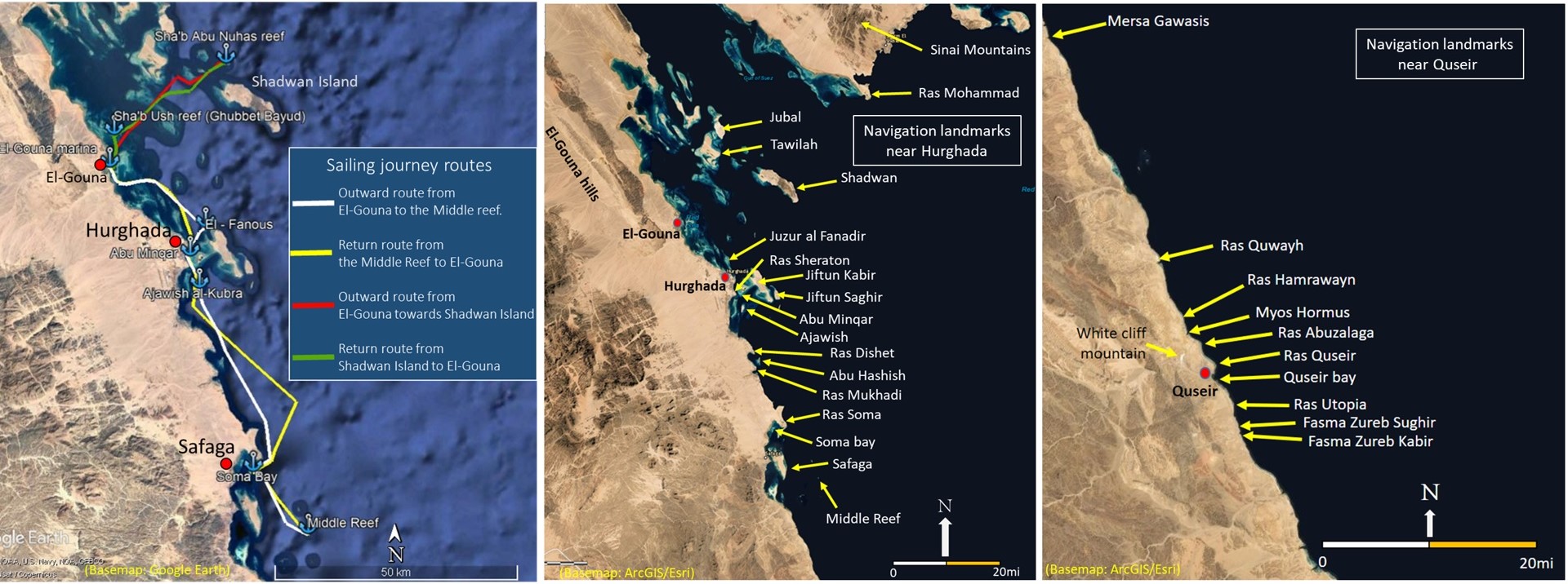
The Red Sea has been navigated since ancient times, probably earlier. The evidence from the archaeological sites such as Ayn Sukhna, Wadi el-Jarf, Mersa Gawasis, Myos Hormos (Quseir al-Qadim), and Berenike suggest that ancient Egyptians, Greco-Romans, Ottomans, and Arabs undertook successful trading expeditions to the southern regions of the Red Sea and beyond. However, very little is known about the navigation techniques of these sailors who were responsible for past maritime connectivity in the Red Sea. Archival research by the grantee suggests that seafarers in the past mainly used landmarks to navigate at sea. This project aimed to investigate these geographic features by undertaking an exploratory sailing journey along the Egyptian coast. The local sailors were also interviewed while observing, recording, and mapping the selected land/seamarks such as mountains, headlands, islands, and other navigational features. Through this ethno-experimental approach, this project has aimed to answer the fundamental questions related to landmark navigation. This included, but not limited to, what are the different types of land/seamarks sailors used? what is their visible range? i.e. from how far landmarks are visible to the naked eye? what are the different factors that influence their visibility? and what is their role in maritime navigation?
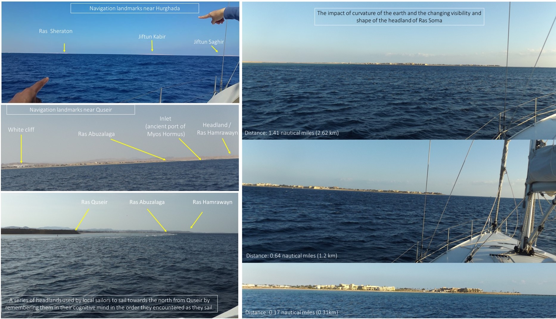
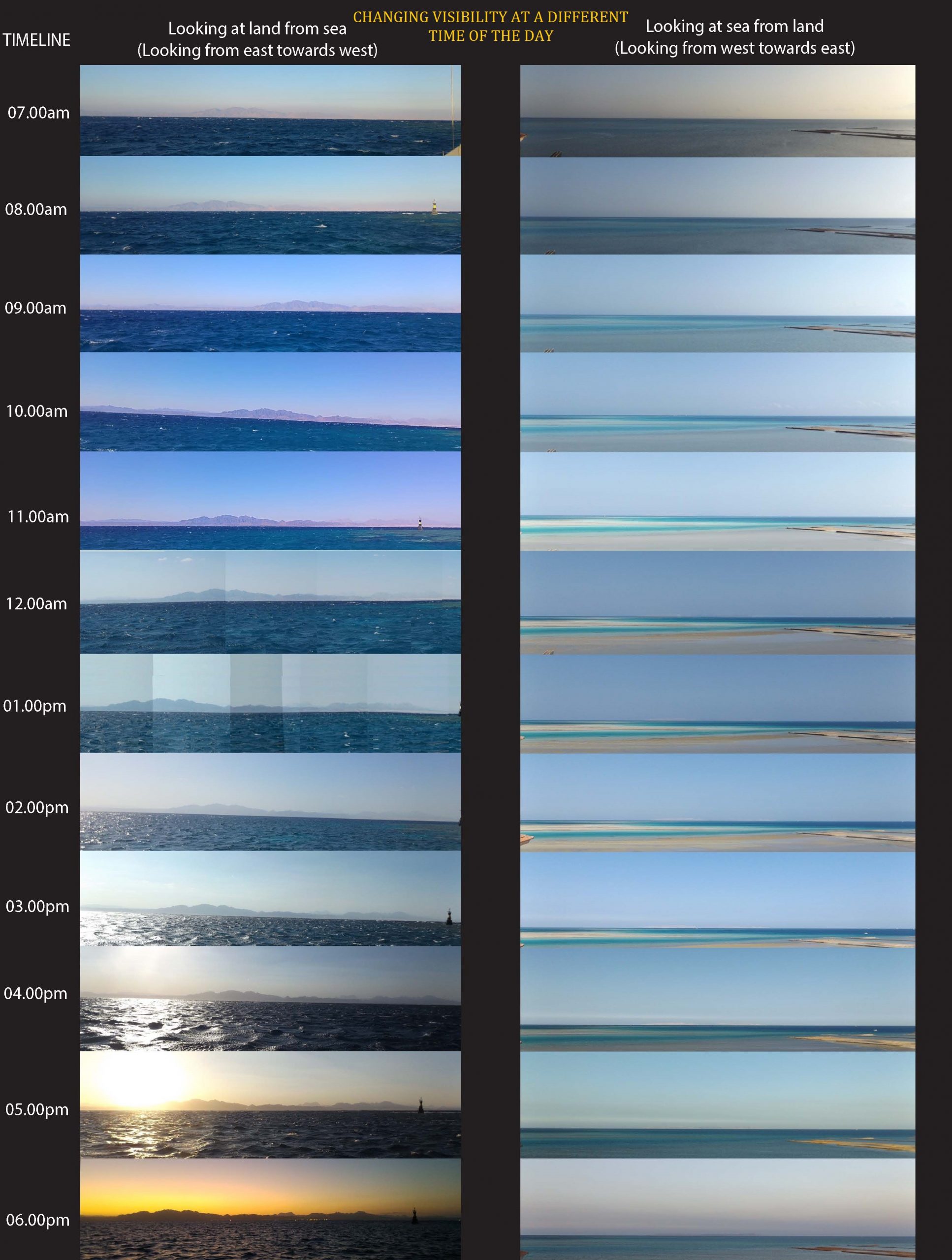
The results from a sailing journey have shown that local sailors used different types of navigational landmarks. Most of these landmarks included headlands or ‘Ras’, inlets or ‘Mersa’s’, islands, and reefs. Considering the visibility of these landmarks, several factors affected their visibility at a different time of the day, such as hazy conditions early in the morning, the dusty conditions and mirage at noon, and the sunlight refraction during the afternoon. The best visibility time in good weather is observed to be between 9:00 am and 11:00 am along the Egyptian coast. How far these landmarks are visible to naked eyes depended upon the aforementioned factors including the curvature of the earth. The observations made during the voyage showed that landmarks played a vital role in navigation and formed an integral part of sailors’ daily navigation planning strategy. The local sailors used landmarks not only to navigate from one place to another but also to identify remote anchorages and maintain course while windward sailing. The project also collected data on local winds by using an anemometer suggesting the strong presence of land and sea breezes along the Egyptian shore that can be used to sail against prevailing winds. The data collected on sound near beach and reef breakers at sea with an audio recorder was analysed in the WaveLab LE 10.0. that showed a difference in sound wave frequencies suggesting that the sound near breakers is different, that perhaps used by sailors in the past to locate reefs at night. Therefore, the soundscape, which was previously overlooked, played a vital role in navigation.